 |
| Grand Traverse Bay - West Arm |
Sunday, November 5, 2017
Drizzly Day
Tuesday, January 19, 2016
Strolling TC
 |
| @SandSnowSun |
Back in October, Bryan and I found ourselves in TC to run some errands. We decided to make a detour and found ourselves strolling downtown on Front Street. Michigan had a beautiful fall, and it was one of those evenings that you can't help but go out and enjoy. We absolutely love living here. The eclectic variety of events and opportunities to stay busy, or to stay not busy; the many corners that are waiting for you to explore even when you think you've explored all of them; and the kindness of the community members all make this a wonderful place to be. The more you explore, the more you realize how much character this old city has...
 |
| @SandSnowSun |
 |
| @SandSnowSun |
 |
| @SandSnowSun |
 |
| @SandSnowSun |
 |
| @SandSnowSun |
 |
| @SandSnowSun |
 |
| @SandSnowSun |
 |
| @SandSnowSun |
 |
| @SandSnowSun |
 |
| @SandSnowSun |
 |
| @SandSnowSun |
Monday, January 18, 2016
"Day"te Trip Part 4
Up the road from the Old Presque Isle Lighthouse was the NEW Presque Isle Lighthouse. At 113 feet, it is the tallest Great Lakes lighthouse that can be climbed by the public. I am happy to claim that I made it to the top!
I must admit, however, that I was a little confused by the claim stated on www.presqueislelighthouses.org--I seemed to remember that one of the Sable Point lighthouses on the west side of the state was taller. After consulting the U.S. Coast Guard website, I did confirm that the New Presque Isle Lighthouse does reach one foot higher that Big Sable Light in Ludington. It was a close "one"!
I must admit, however, that I was a little confused by the claim stated on www.presqueislelighthouses.org--I seemed to remember that one of the Sable Point lighthouses on the west side of the state was taller. After consulting the U.S. Coast Guard website, I did confirm that the New Presque Isle Lighthouse does reach one foot higher that Big Sable Light in Ludington. It was a close "one"!
 |
| Surrounded by woods, the New Presque Isle Lighthouse gives a majestic impression when you drive up. |
 |
| We walked around the keeper's quarters while waiting for others to climb the light tower. What do you notice about this U.S. flag? |
 |
| The view from the top was worth every step! Here we are looking north at the mouth of North Bay. |
 |
| ...looking south... |
 |
| ...and looking southeast. It appeared as if the fall foliage was just beginning to peak with mostly yellows and some light reds mixed in. |
 |
| A common sight in the Great Lakes...a freighter is headed northbound. At first it looked like the Great Republic, however when I later looked up a photo I realized that this is not the case. They look similar though! |
We attempted to make it to the Lighthouse Festival's convention at the Sanctuary Inn, however we didn't make it quite in time. So, before the long drive home we found JJ's Steak & Pizza house in downtown Alpena and ordered ourselves a unique and delicious deep dish BLT pizza--a good way to end the day!
It was wonderful to have the opportunity to spend some quality time with Bryan after having him gone for almost six months. I'm glad he's finally home!
Sunday, January 17, 2016
"Day"te Trip Part 3
NOTE: This is a continuation of a blog post series that I began back in October. I wanted to finish what I originally started. I also enjoy looking back at summer photos during the winter :). Not exactly what I envisioned my first 2016 to be, but they are good memories to reflect on. Enjoy!
The third leg of our journey took us to yet another lighthouse--or more accurately, a set of lighthouses--that I've been eager to climb for quite some time. A half an hour of pleasant driving down Historic Route 23 took us through P.H. Hoeft State Park, just around Rogers City (home of the world's largest open pit limestone quarry!), and to the Presque Isle lighthouses.
I will admit, I wasn't as interested in visiting Old Presque Isle Lighthouse. It seemed small and rather insignificant. I fell in love with its charm, however, the second I laid my eyes on it.
 |
| The keeper's quarters look like a New England cottage. I haven't seen too many 1840's structures in the Great Lakes State! According to www.presqueislelighthouses.org, this lighthouse was build to guide mariners into Presque Isle Bay. |
 |
| Looking at Crystal Point over Presque Isle Bay. |
 |
| This bell has an interesting history. The plaque reads, "This bell was taken from the old Lansing City Hall clock tower when the building was torn down in 1959...It weight 3425 lbs. 60% heavier than the Liberty Bell...It was cast in 1896." You're allowed to ring it! I didn't know that at the time I was there, but definitely would have if I'd been privy to that information! |
 |
| Light Tower |
 |
| The keeper's quarters were awesome. It was quite clear that this building had been hand made. This random photo is here simply because I love this door. |
 |
| There always seemed to be something to look at...and take note of those hand hewn beams. Can you imagine the amount of work that had to go into making them? |
 |
| Must. Have. |
 |
| A pleasant view from the second story. |
 |
| This piece of artwork was amazing to see. This is a hair wreath, also known as hair art, mourning hair art, or hairwork. Women would take locks of hair and weave and braid them into intricate pieces of artwork using thin wire. From the many resources I've skimmed online, it seems that these are more associated with being created when a family was in mourning; however, they were also created from the hair of living relatives. The plaque reads that this was donated by the post office in Onaway, MI. |
 |
| The rafters of the keeper's quarters. |
 |
| We found this old capstan outside along the pathway to the parking lot.Thankfully, there's no heavy anchor to hoist out of the water! |
Although the views would not have been as impressive from this 30 foot tower, in hindsight I regret not climbing to the top. I instead opted to save my money for our next destination...
Saturday, January 16, 2016
"Day"te Trip Part 2
NOTE: This is a continuation of a blog post series that I began back in October. I wanted to finish what I originally started. I also enjoy looking back at summer photos during the winter :). Not exactly what I envisioned my first 2016 to be, but they are good memories to reflect on. Enjoy!
After Ocqueoc Falls, our next stop was at a location I've been wanting to visit for quite some time: 40 Mile Point Lighthouse. I'm a lighthouse enthusiast (kinda hard not to visit at least one when you live in Michigan), having been to over 30 in the mitten state, but Bryan and I haven't ever reached the heart of northeast Michigan, even to drive through.
I must admit that I was quite impressed when we drove up. There was just so much! And it was situated beautifully on the Lake Huron coastline. Lake Huron is sort of the "forgotten" Great Lake in our state. Sadly, people don't see it as being quite up to par compared to the other Great Lakes that we have access to. Truly, it's a hidden gem, and this lighthouse helps it to shine at its best.
After 40 Mile Point, we continued on to Presque Isle...
After Ocqueoc Falls, our next stop was at a location I've been wanting to visit for quite some time: 40 Mile Point Lighthouse. I'm a lighthouse enthusiast (kinda hard not to visit at least one when you live in Michigan), having been to over 30 in the mitten state, but Bryan and I haven't ever reached the heart of northeast Michigan, even to drive through.
I must admit that I was quite impressed when we drove up. There was just so much! And it was situated beautifully on the Lake Huron coastline. Lake Huron is sort of the "forgotten" Great Lake in our state. Sadly, people don't see it as being quite up to par compared to the other Great Lakes that we have access to. Truly, it's a hidden gem, and this lighthouse helps it to shine at its best.
 |
| Bryan and me on the beach at 40 Mile Point. One of my favorite photos of us! |
 |
| 40 Mile Point Lighthouse. According to www.40milepointlighthouse.org, it's located about forty miles southeast of Old Mackinac Point and about forty miles northwest of Thunder Bay. |
 |
| The grounds were very pleasant. |
 |
| There is no bad view here! |
 |
| Beautiful stonework |
 |
| One of the neatest things at Lighthouse Park (the grounds surrounding 40 Mile Point Lighthouse) was the wheelhouse of the decommissioned freighter Calcite. I'm kicking myself for not writing down any information about this. It was very interesting listening to the gentleman tell us about the life of the ship, how they obtained the freighter's wheelhouse, and how many hours went into its refurbishment (I don't remember the number, but it was large!). |
 |
| 40 Mile Point fog signal building |
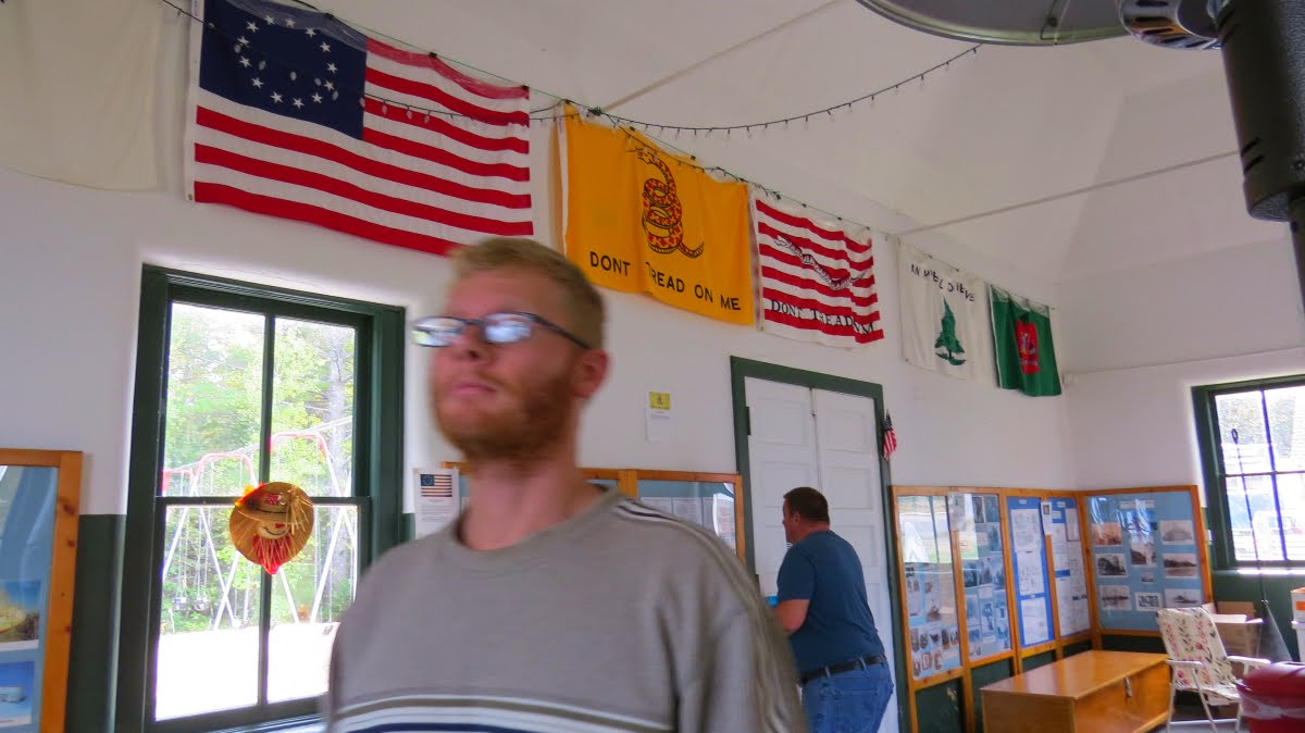 |
| Inside the fog signal building is a load of information and history on the surrounding community. It's also has some tables and chairs for event gatherings. I enjoyed this historic American flag, as well as the number of "Don't Tread on Me" flags. |
 |
| The light tower |
 |
| Near the light tower was a sign directing people down to the beach to view the wreck of the Joseph S. Fay. |
 |
| Looking southeast |
 |
| We found some of the remains of the Joseph S. Fay just a short walk northwest of the path leading from the light tower to the beach. |
 |
| After exploring the grounds, we climbed the light tower. The view was beautiful from the top, as it usually is! |
 |
| From the tower we could see the white bouy indicating where a portion of the Joseph S. Fay ran aground. It eventually broke up and part of it sank in this location. Its story is quite intense, and can be found here. |
 |
| The sun peaking through. |
 |
| More beautiful grounds. |
 |
| We're headed back to our car parked behind the lighthouse and headed to our next destination! |
After 40 Mile Point, we continued on to Presque Isle...
Sunday, October 11, 2015
"Day"te Trip: Ocqueoc Falls
Here Up North, so far we've had a beautiful autumn. There's been minimal rain and somewhat unseasonably warm temps. The result has been more time outside, and a delayed foliage color change. Bryan (now back home after being gone for the majority of the year) and I decided to make up for lost time and go on a "Day"te-Trip this past Saturday. We headed out towards the Sunrise Side of the state, with an end goal of visiting some lighthouses we'd yet to see.


Our first stop was at Ocqueoc (pronounced "Ah-key-ock") Falls (technically) in Millersburg, MI. These falls along the Ocqueoc River have been on my radar for a while. Our trip to the northeast area gave me an excuse to stop. Ocqueoc Falls is the only publicly owned waterfall in the Lower Peninsula. Having only a five-foot drop, it goes without saying that Ocqueoc Falls is not showy or spectacular. It's peaceful and soothing atmosphere is what will draw you in.
A very short path led down to this universally accessible waterfall--the only one in the nation that is available to people of all abilities. We explored both the ramp and stone step pathways. True to its claim, the waterfall was easy to get to. (I can't help but think what a cool experience this would be for a kid...how neat would it be to tell people you got to jump into a waterfall on your vacation??)
These photos were taken as I sat right near the waterfall.
These photos were taken as I sat right near the waterfall.


These photos were taken from atop the ramp that led down to the riverside. This rocky terrain is similar to that in the U.P.--something I haven't noticed much of in the L.P. I also really enjoyed how the fall colors were beginning to show.


Ocqueoc Falls is a part of the Ocqueoc Falls Bicentennial Pathway, a trail system within the Mackinaw State Forest. If you want to make a weekend (or more) trip of it, there's a state forest camp ground across the road from the falls/trail head parking. I'd love to head back there myself and see what the Bicentennial Pathway has to offer.
Stay tuned for more from our "day"te trip...
Stay tuned for more from our "day"te trip...
Subscribe to:
Posts (Atom)